I used to draw maps by hand, but they look so much better when done by the computer. The challenge for me is to learn what ArcMap can do, and remember how to get it to do those things.
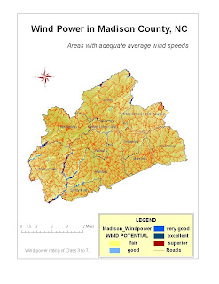
This map is my GIS-111 final project, which is an attempt to show areas that have the best potential to produce wind power in Madison County, N.C.
Based on average wind speed data from a regional wind map, I factored in slope and aspect (direction a slope faces) from DEM's to rank the parts of the county's ridgetops that hold potential for generating power from the wind.
No comments:
Post a Comment